Travel Day:
We had a beautiful drive to West Yellowstone. We had several high passes to get over but none of the grades were low-gear steep so we were happy. It's amazing how much snow is still on the ground (I mentioned when we visited the Flaming Gorge Dam that the Wyoming snow pack was twice normal. It's warming up now and many of the rivers and streams are at or approaching flood stage.
 |
| Coming over the 9,658' Togwotee Pass, our first of 4 Continental Divide crossings on our trip to West Yellowstone. |
 |
| Our first glimpse of the Grand Tetons. |
 |
| Love this view of the Tetons over the Snake River and aspens. We were glad that we stopped to take this shot. As we got closer to Jackson Lake, the views of the Tetons were completely blocked by lake fog. |
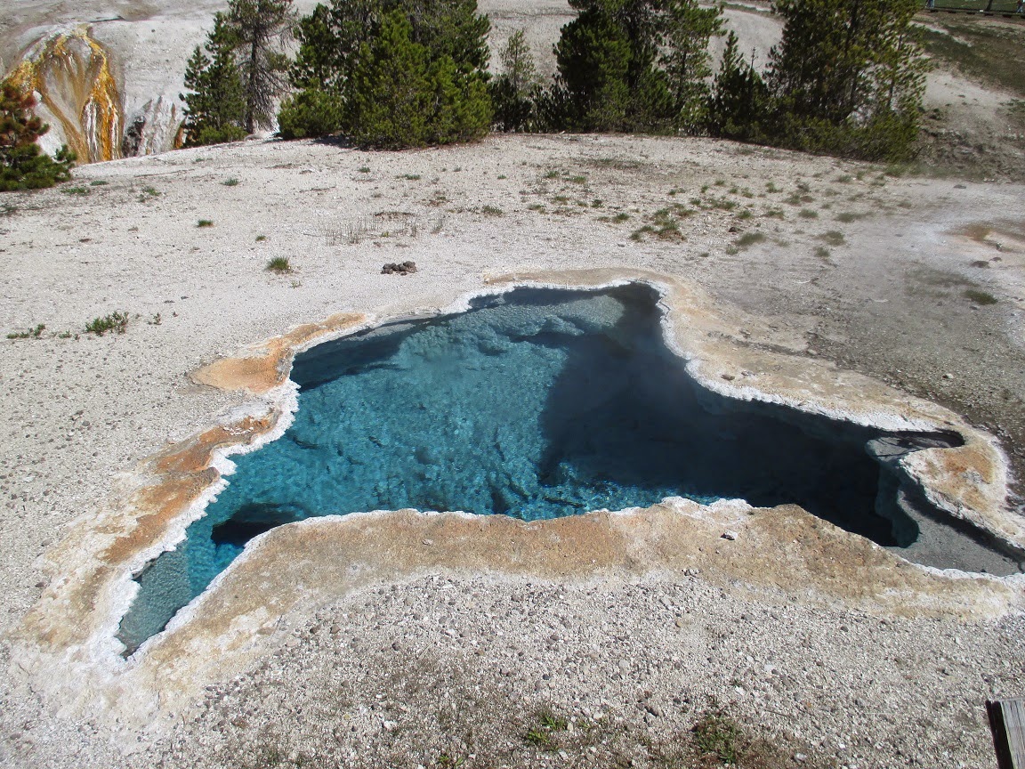
We stopped for lunch at the West Thumb Geyser Basin at the West end of Yellowstone Lake. It's a long way around to the lake so we weren't sure that we'd be back. After eating, we walked through the basin.
 |
| One of the many hot springs. |
 |
| Yellowstone Lake is almost completely frozen over. We were here on these same dates in 2007 and didn't see a bit of ice (sure, we got snowed on but no ice). The heavy snow pack in the mountains bodes well for seeing wildlife down near the roads. |
 |
| Looking into the depths of a hot spring. |
 |
| Looking into the depths of a hot spring. |
 |
| Didn't want to stop while pulling the trailer but we saw some elk and a couple of large bison herds while we were crossing the park. Again, the deep snow pack bodes well for many animal sightings. |
Our campground is about 6 miles West of West Yellowstone and is in a beautiful location. When we arrived, the power to the region had been out for many hours. The water was out too since the pumps are electric. Fortunately, the moment that we plugged in, the power came back on.
 |
| The view from the edge of our campground. The notch is where the road from the West Yellowstone gate goes into the park. |
First full day: Down towards Old Faithful
Our plan for day 1 was to drive down the the Old Faithful area and work back towards West Yellowstone.
 |
| When I look up at the cliffs that surround Yellowstone, I'm reminded that the park is on the floor of an active caldera. |
Bison were everywhere today and we took a ridiculous number of pictures. Here are some of the best:
We got to Old Faithful and it was almost time for an eruption. We decided to watch it erupt, then hike the adjoining Upper Geyser Basin and then have lunch at the Old Faithful Lodge.
 |
| Old Faithful: Waiting for the eruption. |
 |
| Old Faithful: Thar she blows! |
 |
| Looking towards the Upper Geyser Basin from Old Faithful. |
I have no idea what most of these geysers are called.
 |
| Bacteria thrive in the places where the steaming hot water flows into the Firehole River. |
 |
| Looking back at the Lodge. |
 |
| Looking across the Upper Geyser Basin. |
After our hike, we had a great lunch at the Lodge.
 |
| On the way back to the truck, we spotted Old Faithful erupting again. |
On our way back to West Yellowstone, we hit several other geyser basins.
 |
| The lowest pool at the Midway Geyser Basin is always spectacular. |
The Grad Prismatic Spring is also at the Midway Geyser Basin. This was our third visit but it must be our first visit in the bright sunshine. The sun reflecting off the pool turned the steam blues, greens, yellows and reds. These pictures don't come close to doing justice to the reality.
 |
| Also at the Midway Geyser Basin, this is where the boiling water enters the Firehole River. |
Upon our return to West Yellowstone, we went looking for the Grizzly & Wolf Discovery Center. We had no idea where it was but my first guess took us right there.
 |
| The center has 7 wolves. We saw 4 but I think that they keep some of the animals "backstage". This was the least asleep looking one of the bunch. |
 |
| The Center also has Bald Eagles. Josh and Jake have wing injuries that won't allow them to be returned to the wild. |
 |
| The Center has 8 grizzlies but only 5 were on display today. They were a very playful lot. |
Second full day: East to Yellowstone Falls
This was our day for finding new things in Yellowstone. We started out for the Yellowstone Falls, which we have seen twice previously. Along the way, we wanted to stop at Canyon Village for lunch.
The Norris Geyser Basin was along the way. We've never been there but I recently read that it's the most hottest, most dynamic, basin and it has its own visitors center when the others don't (except for Old Faithful). It was too early for lunch so we stopped in at Norris and took the 1 mile loop.
 |
| Steamboat Geyser if the world's tallest active geyser and has eruptions of more than 300'. Unfortunately, the eruptions are rare and unpredictable. The last one, on July 31, 2013, was days before our last visit and made the news all over. It does do 10'-15' spurts ever once in a while. |
 |
| Vixen Geyser is small but predictable - every 10 minutes. |
 |
| Minute Geyser used to erupt once a minute. Early visitors to the park thought that it would be a great idea to throw large stones into the opening. The clogged the opening and the gases eventually found another way out. It now sits as a poster child for abused geysers. |
 |
| Looking across the Norris Geyser Basin. |
After lunch, we headed out to the Yellowstone Falls. We took a wrong turn and ended up on the opposite side of the canyon from all of our previous visits. We've always had our view from Artist's Point on the South Rim. The view was a distant view the larger Lower Falls. We'd never seen Upper Falls.
This time, we found ourselves on the North Rim. Our first stop was called Brink of Lower Falls.
 |
| From the parking lot, you can see Lower Falls (308'). Just on this side of the falls, you can see the viewing platform on the brink. That was our next stop. |
 |
| On our way down to the brink, we got our first ever view of Upper Falls (109'). |
 |
| At the brink - looking toward the edge. |
 |
| At the brink - looking over the edge. |
 |
| At the brink - looking over the edge. |
 |
| At the brink - looking upstream. |
 |
| The brink platform from one switchback up the trail. |
A short distance farther along the road, we came to an observation point.
 |
| Lower Falls. |
We had a couple of significant animal sightings on our way back to the trailer.
 |
| Our first ever wolf sighting! This ranks up there with our grizzly sighting in May, 2007. Sorry about the graininess but it was a long way away and I had to blow it up a bit. |
 |
| Our largest bison herd ever. |
Third full day: Bozeman, MT and the Museum of the Rockies
When I sent away to the various states for information, one place that I saw in the literature that I wanted to visit was the Museum of the Rockies in Bozeman. In planning our route, I tried and tried to get us to Bozeman but it finally ended up as a sidetrip from West Yellowstone - a 96 mile each way sidetrip.
The curator of paleontology at the Museum of the Rockies is Dr. Jack Horner who was a consultant to Steven Spielberg on all of the Jurassic Park movies and was the inspiration for the Sam Neill's Alan Grant character in the movies. The museum houses one of the larges collections of dinosaur fossils in the world and has the worlds largest collection of T.rex and Triceratops fossils.
 |
| Big Mike is a bronze T.rex skeleton at the entrance to the museum. |
 |
| I'm not even sure what this is - Niko could probably tell me. |
 |
| I think that this is an Allosaurus. |
 |
| Triceratops skulls wrapping around the room, ordered from smallest to largest. |
 |
| Triceratops. |
 |
| Small and large T.rex skulls. |
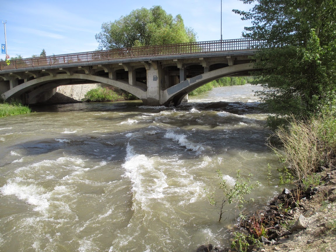
After the museum, we visited downtown Bozeman and had some lunch. On our way back, we were stopped for a very long time for some road construction. Kristen got out of the car and took the following picture of the overflowing Gallatin River. This was probably the calmest spot that we saw all day.
 |
| The Gallatin River. |
Tomorrow, we're off to Salmon, Idaho. We had planned to stay at the same place that Stacy and Jack stayed last summer but the woman who owns the park is very ill and isn't opening her park this summer.
-JC-