We've spent 3 nights in Death Valley. Here's another case where I should have consulted my Mountain Directory before committing to the destination.
I complained the other day about the pass that we had to go through between Ridgecrest and Weldon. We were surprised to see how short and trivial it seemed on the return trip. In retrospect, it really was trivial. The road into Death Valley involved 2 passes and slopes of 7, 8 and 9% (yes 9%). We made it but, coming in, we started at about 4000 feet and ended up at sea level (the sea level sign is across the street). Going out, the grades will be just as bad but with 4000 feet more climb. We've checked and the way that we came in is still the best way out. We'll just have to leave early before it gets hot.
 |
| Stopped here to eat lunch. Wondered why all of the foreign tourists were stopping to have their pictures taken and discovered the sign. |
Here's what we have to fret about the whole time that we're here. As I said, we're at sea level here. The first pass that we'll need to get over is 4956' and the climb includes a 5 mile 8% grade and 2 6% grades that total 8 miles. Beyond that pass, we'll drop 3500' into the Panamint Valley with some downgrades at 9%. Next, we'll have to climb over a second 4700' pass. The 17 mile climb to this pass includes 11 miles of 6-7% grade.
Kind of along the same line, we've noticed that our campsite is just across the road from a historical marker. It seems that in 1849, the only wagon train to ever cross Death Valley in search of a shortcut to the gold country reached this point and gave up. They burned their wagons and ate their oxen before proceeding on foot.
We spent our first afternoon in Death Valley with Jack and Stacy. They were staying in Lone Pine (in the RV park that we'll be in at our next stop) and came over to Death Valley for the day. I don't think that they could believe it that we made it in here. They want to be the first to know when (and if) we make it out. We had a very nice visit and capped it off by going out for an early dinner at the neighborhood saloon. We'll catch up with them again in Portland in a couple of months.
Here are a few picture that we took of the stark, yet beautiful, terrain around our campsite.
We've been to Death Valley once before but, staying in Lone Pine and day tripping, we missed the sunsets and sunrises. They are spectacular and these photos are washed out compared to the real thing.
 |
| Sunset |
 |
| Sunrise |
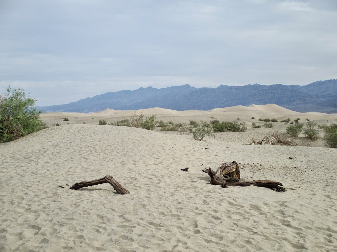
On our first full day, we headed South. Our first stop was the Mesquite Flat Sand Dunes which cover 14 square miles of valley floor.
Next stop was the Harmony Creek Borax Works Interpretive Trail. They used to scrape up the borax rich soil of the valley floor and refine it before shipping it 160 miles to the rail heads. To ship it, they used the famous 20 mule team wagons.
 |
| One of the rigs that the 20 mule teams used to haul borax. The tan held water, the wagons borax. |
 |
| The refinery (it would have been too costly to ship the unrefined material(. |
Next, we passed through Furnace Creek and headed for Zabriskie Point. There's something wrong there. The mound that the sign identifies as Zabriskie Point is probably the least impressive geographical feature there. If Zabriskie named the point himself, he sure didn't know much about points. If someone else named it after him, he should sue.
 |
| We thought that Zabriskie Point had to be the formation on the right (choice A) or else the light colored pointy rock on the left (choice B). |
 |
| Choicer A again. |
 |
| Choice B again. |
 |
| But then there was a sign. |
 |
| This relatively unimpressive rock is Zabriskie Point. |
After Zabriski Point, we headed up to Dante's View near the top of Dante's Peak. The View is at 5475' and it looks straight down at the Badwater Basin which, at -282' is the lowest point in the Western hemisphere.
 |
| Dantes Peak is just a short hike from the parking lot. |
It was time for lunch so we headed back to Furnace Creek. Sandwiches on the menu ranged from $14 to $20. We decided to share an $18 Reuben, figuring that Reuben's are pretty large. The sandwich that came was the thinnest Reuben that we've ever seen. It was even thinner because they'd just run out of sauerkraut and just went ahead without it. The lunch did include a few potato chips however so we couldn't have been happier.
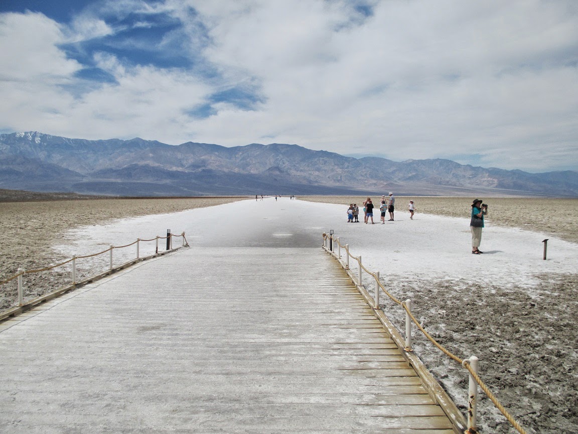
I mentioned Badwater Basin an couple of paragraphs back. That was our next stop.
We ended our first full day of site seeing by driving a loop called Artists Drive and stopping at Artists Palette. The rocks in that area showed some pretty pale pinks, greens and yellows but they were not spectacular. The following pictures almost do them justice.
Our second full day was shorter. We headed North and, while the distances are as great (if not greater) than the South, there isn't quite as much to see. Our first stop was Ubehebe Crater.
I hiked up to a smaller crater that was at the upper edge of Ubehebe.
 |
| Kristen baled on me halfway up. She's in this picture, right at the part where the trail got steep. Our truck is in the distance. |
Then we visited Scotty's Castle. Scotty was a fantastic conman and liarwho kept the owner of this place so entertained that he provided him with a place to stay.
 |
| House on the left, garage on the right, guest rooms upstairs. |
 |
| Modern bathroom. |
 |
| This room is built around a Welte-Mignon organ that is one of the few functioning examples still in existence. Think of it as a player piano on steroids (a player orchestra). |
One final note: Our attempt to pull the trailer out of Death Valley was a success. We got on the road at 6am to beat the heat and the traffic and the climb out was almost uneventful.
-J-


No comments:
Post a Comment