The first thing that we needed to find out once we reached Concrete is how such a beautiful place came to be called Concrete. It seems that they found some rather rich limestone deposits in the area. That, combined with the wealth of hydroelectric power in the area, led to the town becoming the primary source of the concrete that was used in building Seattle. The town tried on other names for size before hitting on Concrete. It was a coal town first and was called Baker River. Later, before they started cranking out the concrete, they were a primary source for portland cement so they called themselves Cement City (Portland must have already been taken). Kristen says that somewhere in there they were also called Minnehaha.
 |
| The Concrete sign on some old cement silos (the name was apparently painted on the silos for a movie that was set here a few years ago. |
I mentioned that this is a beautiful place. The growth is huge, dense and green. The evergreens are mostly hemlock and cedar. The evergreens are far outnumbered by the broad-leaved deciduous trees. The fall foliage here must be amazing. Just look at this first couple of shots of our site and you'll see what I mean.
 |
| Kristen couldn't resist going airborne on this trampoline-like balloon-like thing. |
Our first whole day: North Cascades National Park
We just realized that North Cascades is the 15th National Park that we have visited on our trip (and more are yet to come). Like many National Parks, North Cascades is mostly undeveloped. The only road cuts across the small waist of the park. It's very beautiful except for the fact that that same route has been developed for hydroelectric power and it's just about impossible to take a photo of the mountains without including high tension lines.
Our first stop was at the Visitors Center where we took the 1.8 mile River Loop hike down to and along the Skagit River.
 |
| Along the River Loop Hike. Everything was covered with thick moss. |
 |
| Closeup of the moss. |
 |
| Dense, dense woods. |
 |
| Finally, the Skagit River. |
Next, we drove a little farther on and hiked the Ladder Creek Falls Trail which included a visit to the Gorge Powerhouse. An interesting thing about the Gorge Powerhouse is that it sits about 2 1/2 miles downstream from the dam and reservoir that power it. The dam itself isn't that high so it releases its water into a large pipe that runs downhill to the powerhouse. The water, racing downhill, builds up sufficient force to turn the 4 turbines.
 |
| The Gorge Powerhouse. |
 |
| The lowest rung in Ladder Creek Falls. |
 |
| The next rung up. |
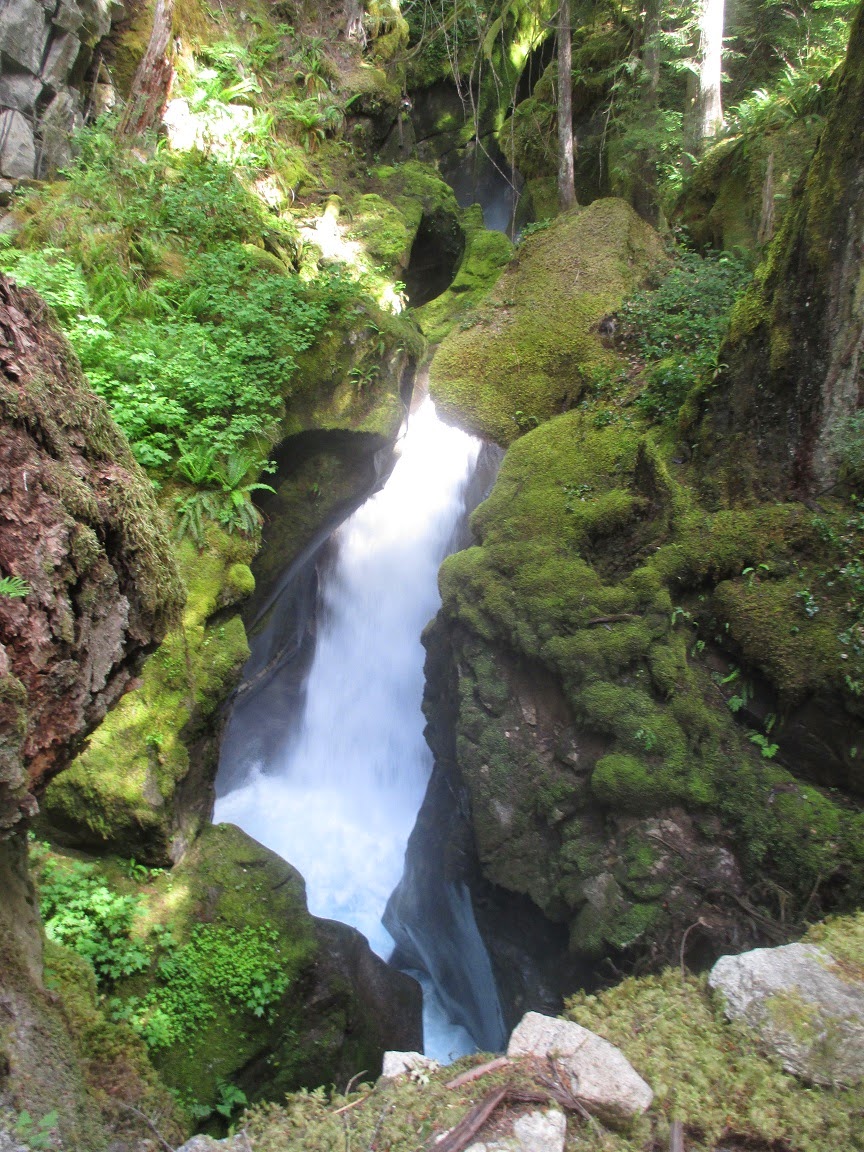 |
| Still another rung. |
 |
| And another (there may be more but the trail stops here). |
 |
| Beautiful Rhododendrons outside the powerhouse. |
 |
| 2 of the 4 turbines in the Gorge Powerhouse (blurry because of the very thick glass) |
Before leaving the park, we wanted to see Gorge Dam (2 1/2 miles upstream from the powerhouse). I harbored the hope that, once we were above the powerhouse, I'd be able to take a picture of the mountains without the power lines. No such luck. I now realize that there are at least 2 more hydroelectric dams along the Skagit River above Gorge Dam. The final reservoir stretches well into Canada.
 |
| The Gorge Dam. |
 |
| Closeup of those mountains in the gap beyond the reservoir. |
 |
| Finally, some relatively unobstructed mountains. |
 |
| And more (but I still see some high tension lines in there). |
On our way back to Concrete, we stopped at a restaurant that was staffed by Russian Olympic athletes and served burgers made from a very odd assortment of animals. They had the usual buffalo and elk (and even beef). They also had kangaroo and camel among other things. I had a very tasty wild boar burger. Kristen had beef (boo).
Our second full day: Rain, a fish trap and another dam
It started to pour at about dusk on our first full day and continued through the night. It started easing in the morning but never quite stopped. It was a good morning to drive down to Sedro-Wooley to get the truck's oil changed.
After lunch, we decided that we need to do some sightseeing so we headed for what we thought was the Baker River Fish Ladder. The fish ladder ended up being a fish trap. The salmon can't get to where they need to get on their own so they trap them here and taxi them 3 dams upstream. They do this for something like 60,000 salmon each summer. The first salmon arrived yesterday. So far, it's the only salmon. Things were understandably slow at the visitors center so the woman in charge gave us a personal tour of the operation.
 |
| This obstruction was probably put there to force the salmon off to the right ... |
 |
| ... and through a pet door sized opening into this pool ... |
 |
| ... and through other openings into smaller pools ... |
 |
| ... until they enter the cylinder on the right, rise to the top and exit through a shoot. Then they are sorted, tanked and taxied. |
After visiting the fish trap, we wanted to see where they taxi them to so we headed upriver to the Baker River Dam.
 |
| The back of Baker River Dam. |
 |
| Looking across the reservoir from the dam. |
 |
| Looking down at the powerhouse. |
 |
| Looking across the reservoir. |
Tomorrow, we're off to Port Ludlow, WA. We'll be taking a ferry to get there so that should be exciting.
-JC-


I think I really like this Concrete place-- it's so pretty!! Also, the rhododendrons in MA are insane right now. They are EVERYWHERE! You would love it! :)
ReplyDelete